Two different projects are currently underway in the Lake Champlain-Richelieu River system that will assist the International Joint Commission in responding to two recent requests from Canadian and US governments. Though in the same watershed, each project has unique objectives, funding structures, and timeframes for completion. Let’s take a closer look at both requests and what they’ll mean for people concerned about water quality and flooding.

The Lake Champlain-Richelieu River flooding study
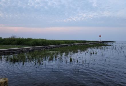
Given the susceptibility of the Richelieu River to flooding, governments have asked the IJC to carry out several studies related to high water events over the past five decades. Nevertheless, the impacts of extreme precipitation in the Lake Champlain basin during 2011 will not soon be forgotten. So, in 2016, in response to a 2013 Plan of Study from an IJC work group, the Canadian and US governments asked the IJC to examine the causes, impacts, risks and solutions to flooding along the shores of Lake Champlain and the Richelieu River. With funding valued at CDN$11.3 million (US$8.7 million), the IJC established the Lake Champlain-Richelieu River Study Board, with a directive to deliver a final report in 2021.
Two of the major outcomes expected from the flooding study are a binational flood forecasting system to better prepare communities to respond to high water events, and a set of recommended options for reducing the likelihood and impacts of flooding in the basin.
You can learn more on the study web page, including how a Public Advisory Group is working to gather and pass public feedback to the study board.
The review of nutrient loading and impacts in Lakes Champlain and Memphremagog
Similarly with water quality, and particularly the chronic presence of nutrients and algal blooms in Lake Champlain and Missisquoi Bay, governments last year requested that the IJC review scientific data and current measures being taken to address water quality concerns, and recommend ways to strengthen these efforts. This request also included a review component for Lake Memphremagog.
While not a traditionally-funded study, the IJC is collaborating with established watershed associations over two years to provide recommendations on the best way forward for those jurisdictions responsible for researching and managing these lake systems. The IJC encourages public participation throughout the study. You can visit the study web page and subscribe to updates to learn more and stay connected to this project.
Shared solutions—shared benefits
Though separate initiatives, the Lake Champlain flooding study and the review of nutrient loading and impacts will complement each other in contributing to healthy waters in the basin. Some examples:
- Some land management practices that help protect downstream water quality also make communities less vulnerable to the impacts of flooding. For example, new agricultural practices to conserve nutrients and increase soil moisture could also reduce the intensity, timing and volume of floodwaters.
- Restoring river flows and wetlands in Lake Champlain could reduce sediment and nutrient runoff.
- Protecting shoreland may restore and conserve vegetation that filters pollutants and prevents erosion.
In both cases, experiences and perspectives of the public as well as policymakers, scientists and policy analysts will provide important feedback and enhance recommendations from the two initiatives.
Want to have your say? Send your feedback to the Lake Champlain-Richelieu River Study at lcrr@ijc.org or contact us at lclm@ijc.org regarding the review of nutrient loading and its impacts in Lakes Champlain and Memphremagog.
Subscribe to our Newsletter!