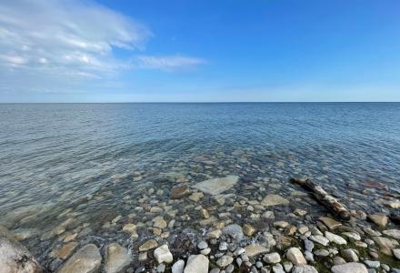
Knowing how high the waters have been in the past is important when looking at waterfront development. A pair of markers denoting the highest recorded levels of Osoyoos Lake aim to make people aware of the past when planning for the future.
Osoyoos Lake straddles British Columbia and Washington state. For people who live near the water and those who haven’t, it can be easy to lose sight of how dramatically water levels can change over time, said Kris Kauffman, water resource engineer and member of the IJC’s Osoyoos Lake Board of Control. The markers provide a visual aid to help people understand record flood levels the lake has seen in past decades – notably the high water years of 1894, 1948, 1972 and 2018.
“I’ve been involved with water up the Okanogan River for over 50 years, and I’ve found it important that people have some idea what’s going on,” Kauffman said. “Unless they have a physical marker, it’s hard for them to believe how things change over the years, or from year to year.”
The markers were funded through the IJC’s International Watersheds Initiative at US$8,000. One of the two was installed in Osoyoos, British Columbia, in a public space near the Osoyoos Bridge and waterfront in 2019, Kauffman said. The other will be installed in Osoyoos Lake Veterans Memorial Park in Oroville, Washington, sometime this summer at a location that has not yet been finalized. The installations consist of markers in the lake and informational stands on nearby land.

Kauffman said he had the initial idea for the markers after visiting family and seeing a marker where the Missouri River meets the Mississippi River that denotes how high floodwaters were there in 1993. With new people moving into the Osoyoos Lake area, Kauffman thought it was a good idea to have that information visible for people to plan development projects or for considering protections against future floods.
Kauffman said much of the development on Osoyoos Lake has been on the Canadian side, where high water even below the flood stage can cause the shoreline to disappear under the waves and limit the ability of recreational boats to get under bridges.
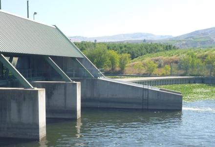
While the lake has a regulatory dam, the layout of the river system makes it susceptible to a “backwater” effect under certain conditions. Osoyoos Lake flows into the Okanogan River, and below the Zosel Dam the Okanogan meets up with the unregulated Similkameen River.
When flows from the Similkameen are too great, it can flow north up the Okanogan, over the dam and into Osoyoos Lake. Kauffman said this is just a natural part of the system that the dam had to be built around. But it also means there is a limit to how much control dam operators have to prevent flooding in those circumstances. The current dam has existed since 1987; it replaced an older mill dam that was built in the same location back in 1927.
That said, the highest flood recorded took place in 1894, before any kind of regulation existed on the lake, when waters got as high as 280.05 meters (918.8 feet). For comparison, the 2018 flood was similar at 279.31 meters (916.38 feet). Kauffman said he was particularly pleased that this was included on the markers, as outside of local historians, the 1894 flood has been largely forgotten by the local population.

Kevin Bunch is a writer-communications specialist at the IJC’s US Section office in Washington, D.C.