To fully understand how water moves through the landscape, you need to have good maps of the surface as well as the beds of lakes and rivers.
The International Osoyoos Lake Board of Control recently wrapped up a study to do just that, using digital photography and Light Detection and Ranging (LIDAR) surveys from aircraft to map out the lakebed of Osoyoos Lake to a depth of 10 meters (32.8 feet), along with portions of the Okanogan River and the Similkameen River on both sides of the Canada-United States border.
The contractor for the project, NV5 Geospatial, also carried out ground surveys to ensure the accuracy of the aerial photography and LIDAR scans. Since Osoyoos Lake is largely shallow, this scan mapped out the majority of the lake bottom.
“What that allows you to do is drain the lakes, digitally,” said Anna Warwick Sears, a member of the International Joint Commission’s (IJC) Osoyoos board. “You can see how the topography changes from the top of the mountains down into the lake, and better understand the volume of water it can hold.”
This is important to allow for a detailed picture of how the topography and water levels of the lower Similkameen River affects those of the Okanogan River, and with it, Osoyoos Lake, Sears said.
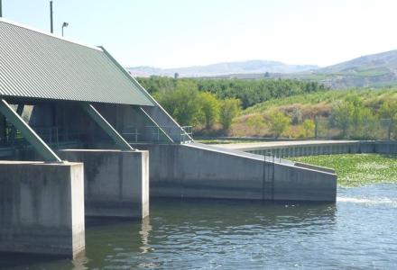
The two rivers meet just downriver of Zosel Dam and Osoyoos Lake. When there are high outflows on the Similkameen, it can end up pushing water back upriver on the Okanogan into Osoyoos Lake. This in turn can cause unexpected flooding along the lakeshore. This occurred in November 2021, Sears said, when a plume of sediment-laden water pushed upstream past the dam and flooded areas around Osoyoos Lake.
The Osoyoos board is already developing a hydrologic model for both rivers as part of its broader Climate Change Guidance Framework efforts, to determine how climate change will impact the board’s ability to fulfill its responsibilities. Sears said this bathymetry data will be factored into a combined model to better predict what will happen at the confluence of the two rivers under different climate scenarios. The board can then recommend any changes that may be needed to its IJC Orders on the operation of Zosel Dam to account for future events.

A LIDAR view of the Okanagan and Similkameen Rivers near the Whistler Canyon Trailhead. The coloration is used to show the topography of the surface and riverbeds. Credit: NV5
“If you’re trying to make drought declarations on Osoyoos Lake, in order to do that and figure out the risks, you have to take into consideration the flows in the Similkameen and Okanogan systems,” Sears said. “It’s been getting more difficult to make accurate predictions because we keep getting weird climate events, so hopefully this will help us fine tune the operating orders.”
Beyond climate change, this data is helpful for infrastructure planning and fine-tuning flood maps and risk mitigation plans, as highlighted on the IJC’s International Watersheds Initiative project page.
The Canadian survey portion of the Osoyoos board study was carried out by the Canadian Okanagan Basin Watershed Board, while the IJC’s International Watersheds Initiative financed the survey over the US portion of the watershed to ensure a seamless dataset for the region.

Kevin Bunch is a writer-communications specialist at the IJC’s US Section office in Washington, D.C.
Subscribe to our Newsletter!