This is the fourth article in a series highlighting how communities along the Great Lakes and St. Lawrence River are using innovative solutions to adapt to the current period of high water levels, focusing on work in Minnesota and Ontario to prepare for extreme water levels in the future. Previous articles have covered resiliency efforts on Lake Ontario and the St. Lawrence River, lakes Michigan and Huron, and Lake Erie and the Niagara River.
Spotlight: Lake Superior
Despite being the largest of the Great Lakes, Lake Superior is the least densely populated. Its shoreline, including islands, spans roughly 4,350 kilometers (2,700 miles) and much of it remains wild and undeveloped. The harsh, rocky shoreline and northern climate are poor conditions for agriculture and settlement.
About 230,000 people live along the Superior shoreline in Canada, around half of them in Thunder Bay, Ontario. In the United States, the shoreline population is about 445,000 and spread across several small lakeshore towns, with the largest city being Duluth, Minnesota (population 85,000). The St. Marys River is the outlet of Superior and feeds into lakes Huron-Michigan.

As the largest, coldest, deepest and most pristine of the Great Lakes, Superior has been spared from the worst environmental stresses facing its fellow lakes. Historically, most of the lake has been too cold and nutrient-poor for algal blooms and invasive species to thrive. But with the climate changing, occurrences of harmful algal blooms have appeared in recent years due in part to warming waters.
Like the rest of the Great Lakes, climate change also is contributing to more frequent intense storms and extreme highs and lows in the lake’s water levels, with high waters causing flooding. Intense storms bring large amounts of rainfall that wash more nutrients into the lake, contributing to water quality and algal bloom issues. Communities along its shores have been forced to reckon with these new conditions and are taking steps to prepare their infrastructure and shorelines against high waters.
Minnesota
Located on the western shore of Lake Superior in Minnesota, the city of Duluth has suffered from multiple severe storms in the past decade, energized by a warming climate and lake. Between a flood in 2012 and three successive punishing wind and wave disasters in 2017 and 2018, the city’s management recognized that they had work to do to protect the port city’s shoreline and infrastructure.
“It brought to very vivid life the consequences of climate change for Duluth, and the kind of harms that we will incur if we do not make our community more resilient,” said Jim Filby Williams, Duluth’s director of public administration.
According to Williams, this resiliency effort has two major aspects. To help mitigate flooding, the city is pursuing the purchase of about 3,000 acres of open space, much of it wetlands, which will then be protected, and where necessary, restored or strengthened.
Wetlands can help store water that would otherwise flood parts of the city. Williams said the effort is being done in collaboration with other agencies, adding that some of these wetlands are already protected but have been degraded over the decades so that they no longer function as effectively as a holding area. He said restoring their ecological functionality and ability to retain water will be a key effort under Duluth’s wetland initiative.
This purchase effort should kick off in 2021, he said, with $3.5 million worth of river-adjacent land being paid for through a $700,000 grant from the Environmental Protection Agency and a $2.8 million discount from the property owner. Another upland portion of land worth $3.9 million is being purchased through a multi-party land exchange, and Williams said Duluth does not expect to pay more than a modest amount of cash for it beyond that.
Minimizing damage from storm surges is another concern. Duluth is working with the Federal Emergency Management Agency (FEMA) and state to restore portions of the shoreline destroyed in 2017 and 2018 to a more resilient and sustainable form.
Where possible, existing assets and infrastructure are being removed from the shoreline without being replaced, with some minimal work to stabilize and naturalize the waterfront in these areas. Where that’s not possible, the city is looking at a “managed retreat” of public infrastructure along the water, Williams said, to get it out of harm’s way.
“We’ve got one mile-long segment of shoreline where we’re doing that, obliterating the historic road and moving everything 200 feet (61 meters) inland and restoring and naturalizing the formerly paved shoreline area.”
But these approaches aren’t viable everywhere along Duluth’s waterfront, and in the rest of these areas – either due to highways, train tracks or other major infrastructure – the city cannot move inland without running into structures it has no jurisdiction over.
In these cases, the approach is to try and strengthen what’s already there through coastal engineering, such as building out beaches using dredged materials and adding interlocking car-sized stones inland and offshore to break up waves. The goal is to be able to keep these structures standing over the next 50 years, Williams said.
Duluth has been working with FEMA to assess the city’s public shoreline areas and offer options to reduce threats in specific areas. Bluffs are eroding along the shoreline, putting infrastructure like roads and stormwater lines at risk and making the effort all the more urgent.
The city’s Imagine Duluth 2035 plan details all of these efforts. Williams said while the current focus is on high water levels, the plan recognizes that extremely low water levels pose their own risks to places like the city’s harbor. As a result, the city will likely need to work with the Duluth Port Authority to determine what course of action should be taken in those circumstances.
Ontario
Ontario also is taking steps to increase its resilience to flooding across the province.
In 2019, following major floods in various parts of the province and above average water levels which led to flood watches being issued by two conservation authorities along the coast of Lake Superior, Ontario launched a special investigation.
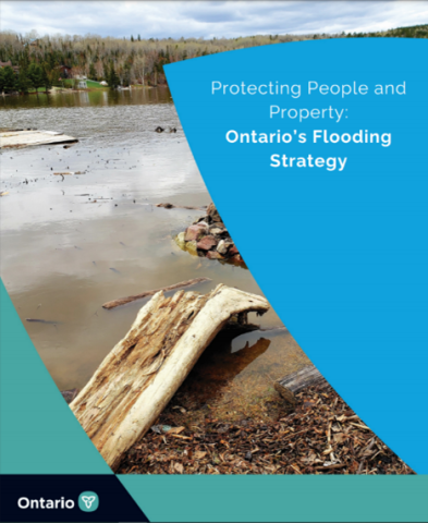
A resulting report provided numerous recommendations to improve resilience and flood mitigation, after which Ontario developed its 2020 Flood Strategy and began several initiatives to bolster flood resilience in cities and municipalities.
One such action began in August 2020 with a first-ever, province-wide climate change impact assessment that will identify where and how climate change will most impact Ontario communities and infrastructure.
The assessment will provide municipalities and communities with up-to-date information about regional impacts that particular communities are facing and will face in future.
This information is intended to help the province, as well as municipalities and Indigenous nations, prioritize projects to make their shorelines more resilient. Results from the assessment are expected sometime in 2022.
In 2019, Canada also invested $13.2 million through its Disaster Mitigation and Adaptation Fund into a project in Thunder Bay to mitigate extreme flooding events and enhance stormwater infrastructure.
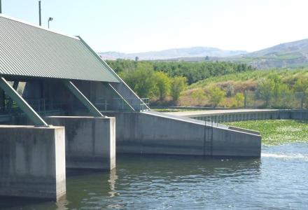
The city of Thunder Bay also is contributing $19.8 million to the project, which will be used to upgrade the Boulevard Lake Dam on the Current River to increase its capacity to handle flood waters and improve the city’s sewage and stormwater systems.
The upgrades will protect residents from flooding during extreme weather events and reduce local economic losses associated with flooding, officials say. In the long term, the project is expected to save the city about $15 for every $1 invested on recovery and replacement costs.

Kevin Bunch is a writer-communications specialist at the IJC’s US Section office in Washington, D.C.

Christina Chiasson is a policy analyst for the Canadian Section of the IJC in Ottawa, Ontario.