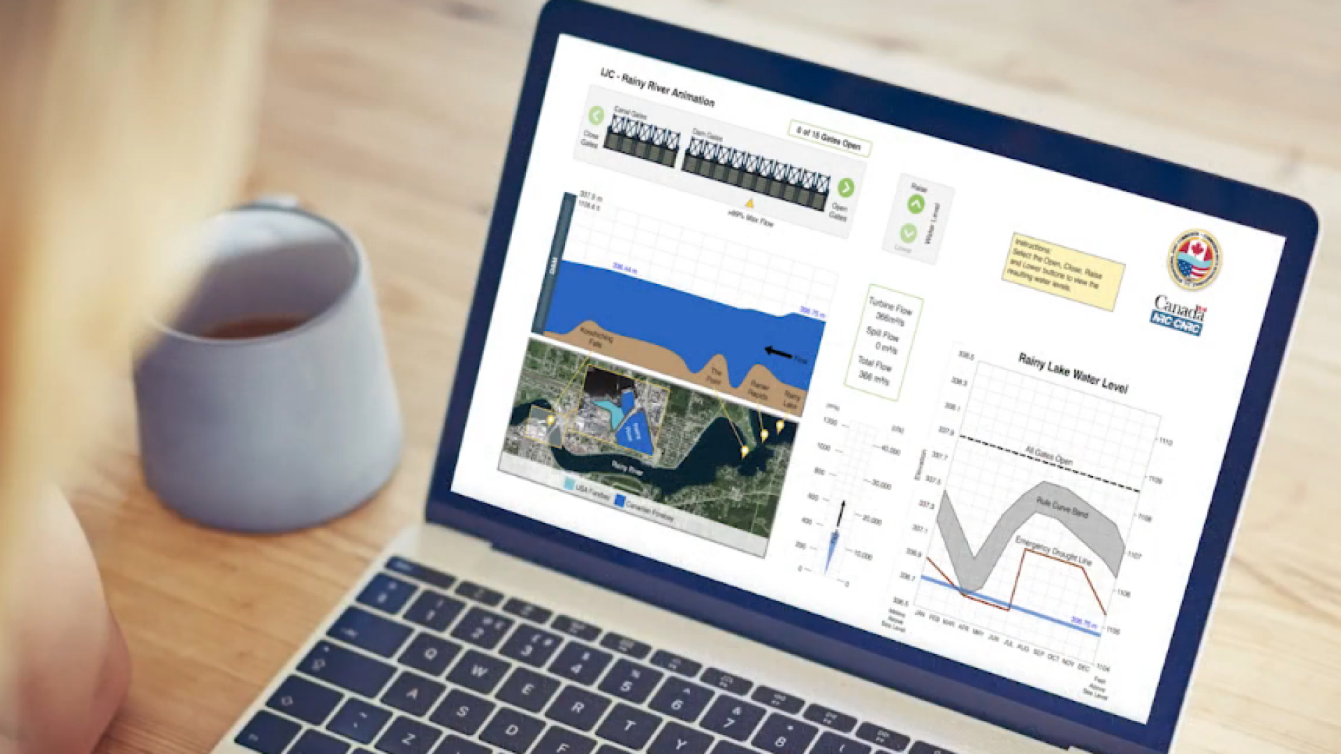
The IJC’s Rainy-Lake of the Woods Watershed Board and the National Research Council Canada have released a dam simulation program that allows users to see how different arrangements of dam gates on Rainy River between International Falls, Minnesota, and Fort Frances, Ontario, will impact water level and flows under different water level situations.
Users can get an idea of what dam operators consider as they manage water flows using the dam gates, along with the impact this has on the upper Rainy River. The aim is to keep waters within a rule curve, or range of water levels the IJC requires dam operators to try and maintain throughout the year to balance recreational, hydropower, environmental and drought or flood risks.
Crucially, the simulator also shows the physical limitations that dam operators must work within during periods of low and high water.
The tool features two interactive elements. The first allows for adjustments to the water level on Rainy Lake. The water level gauge allows for different points on the Rainy rule curve, from its absolute lowest point (and, depending on the time of year, under the emergency drought line) to several points well above the rule curve band, when Rainy Lake is in flood stage. The rule curve graphic also indicates the point at which the rule curve prescribes all gates on the dam to be open to maximize flows out of the lake.
The second interactive element allows the user to select how many gates are open on the dam, including the canal gates. A yellow triangle indicates how many gates must be open at a particular water level to achieve more than 99 percent maximum water flows out of Rainy Lake. Opening additional gates beyond that point has a minimal impact on overall flows through the river due to its geography.
The tool indicates what flows look like under different water level and gate arrangements, and color codes its imagery to denote the different depths that the Canadian and US portions of the dam are built on (which also impacts how flows move through the river).