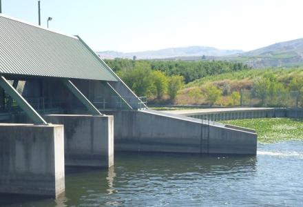

More frequent and severe storms have brought unprecedented amounts of additional water to the Great Lakes basin since 2013, resulting in a rapid rise in water levels and devastating storm wave attacks on almost 11,000 miles of US and Canadian coastlines.
Great Lakes coastal resiliency is being tested to the utmost in this current regime of rapidly rising levels, unprecedented on our coastlines. Resiliency, as defined by the US National Oceanic and Atmospheric Administration, is the ability of a community to "bounce back" after hazardous events such as hurricanes, coastal storms and flooding – rather than simply reacting to impacts.
Lakes Michigan and Huron water levels began to rapidly rise in 2013, after an unusually long 14-year period of low water. From the record-setting low water of 2013 to a peak in July of 2019, a full 6.1 feet of lake level rise occurred over a period of six years. That’s more than 73 inches in six years, compared to a 5-6 inch rise in East Coast sea levels over the past 100 years.
In the Great Lakes, level changes occur over decadal time periods of 10 years or more. Decadal rise and fall gives Great Lakes beaches, both the above and below the water portions, time to fully adjust to the new water level and wave energy regime.
Great Lakes beaches adjust by always maintaining an offshore profile in equilibrium with the new water elevation and wave climate regime: The shape the beach naturally provides for the least loss of sediment to the offshore. Sand is removed by waves from the visible part of the beach and stored offshore in underwater sand bars, which cause storm waves to break in deeper water.
The coastal devastation brought about by the recent rapid rise in Great Lakes levels, coupled with more frequent and intense storm-generated waves, has provided a “teachable moment” for coastal residents, communities and resource managers. With advanced geospatial technology, we are now able to provide a more than 80-year look (dating back to 1938) at the Michigan shorelines of lakes Michigan and Huron down to the detail of an individual property.
This information is available on a public website, allowing detailed examination of how a section of shoreline has responded to both natural and human-induced changes and provides a projection of the coastline for 30 years into the future.
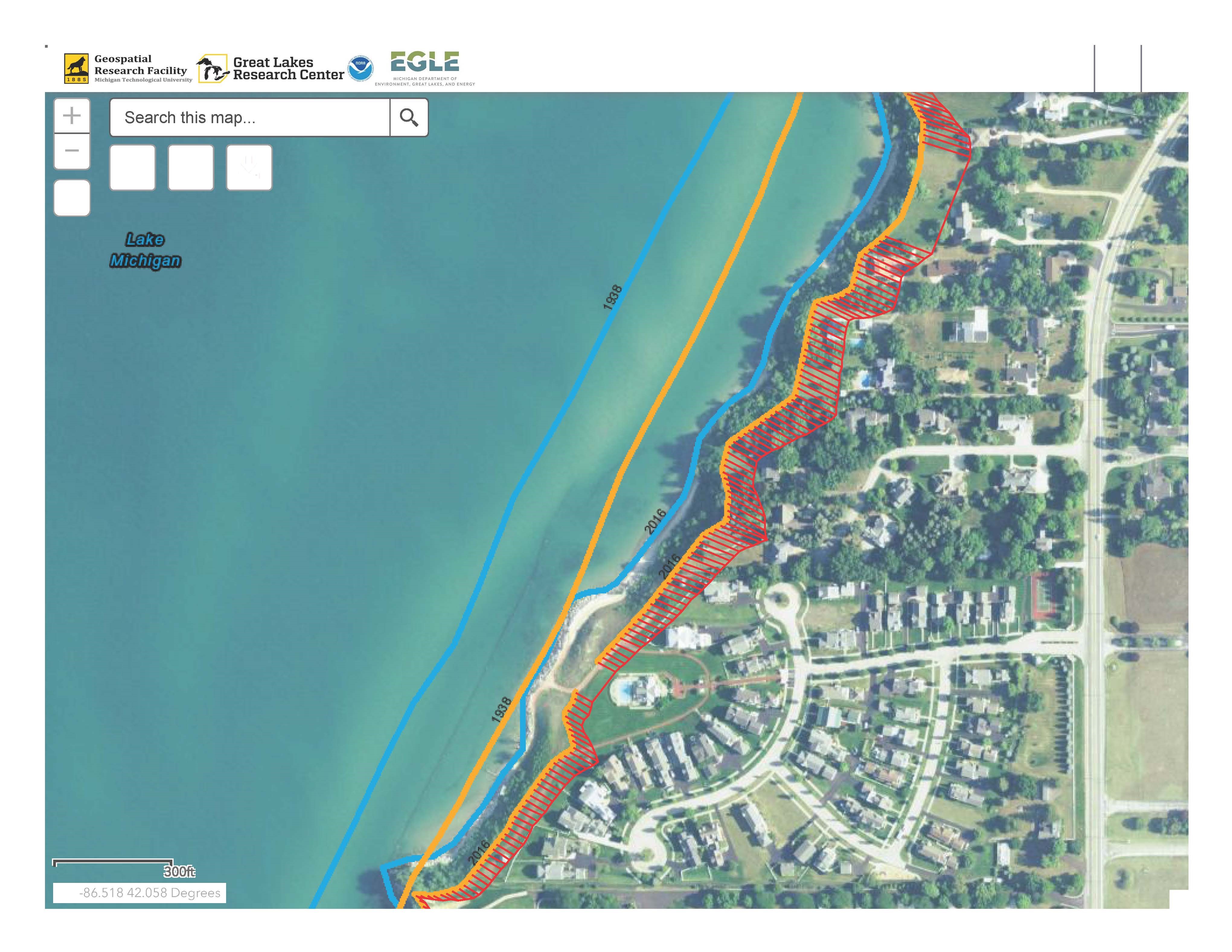
This has produced a stark realization about the changes that have occurred to Michigan’s shorelines during the past eight decades. It provides a visual picture of the impacts of man-made structures of all sizes as well as the loss of public beaches.
Michigan Tech’s Great Lakes Research Center looks at past coastal change and applies advanced technologies to better understand, monitor and predict the future of our Great Lakes.
With partners at other universities, public service organizations and state agencies, we deliver coastal planning workshops to help communities begin to prepare for greater resiliency. These workshops provide discussions of the dynamics of coastal environments, the implications of these dynamics on coastal change, the expected impacts of both high and low water regimes and the impact these conditions will have on existing and future infrastructure at risk. The goal of these efforts is to assist coastal communities to realize their vulnerability to potential future changes in Great Lakes water levels and wave conditions and take steps to adapt to possible future conditions.

Guy Meadows est professeur Robbins de génie maritime durable et directeur-fondateur du Great Lakes Research Center.