By the International St. Lawrence River Board of Control
Despite a return to more seasonable conditions in April and May, water levels throughout much of the Lake Ontario-St. Lawrence River system remained well below average through most of the spring following an exceptionally cold and dry winter.
While water levels have more recently recovered following wet weather at the start of June, the lower than average levels, though not particularly unusual, have been cause for concern among many basin residents, particularly recreational boaters. Here, we provide background on circumstances leading to recent water level conditions, and information on what we might expect in coming months.
Water supplies and the winter that was
Water levels on Lake Ontario are primarily determined by the lake’s net total water supplies, which include water received from the Lake Erie basin (through the Niagara River and Welland Canal), and water received from the Lake Ontario basin itself, including precipitation on the lake’s surface, and runoff from the surrounding drainage basin, minus water lost through evaporation. Water supplies can vary widely and are difficult to predict. The past several months have been a good example of this.
Few will soon forget just how cold it was this past winter. Temperatures were generally 1-4 degrees C (1.8-7.2 degrees F) colder than normal throughout the Great Lakes region.
February in particular was exceptionally cold, with record-low temperatures across the Lake Ontario-St. Lawrence River basin (Figure 1), including at Rochester and Syracuse, N.Y.; and at Toronto, Ontario, and Montreal, Quebec. The record-cold temperatures resulted in near-record ice conditions on Lake Ontario, with ice cover reaching a peak of more than 80 percent, the highest since 1979.

Some might also remember it being snowy this winter. Yet despite heavy snowfalls in some locations (both Rochester and Syracuse received more than double their normal February snowfall), in general, basin-wide precipitation was below-normal throughout much of the winter (Figure 2).

Furthermore, much of the snow received was lake-effect, with cold, dry arctic air masses from the north absorbing Lake Ontario water before dumping it onto the lake’s southern shores, with no net gain to the basin. The record-cold temperatures also kept that snow from melting, delaying the start of spring runoff until later than normal.
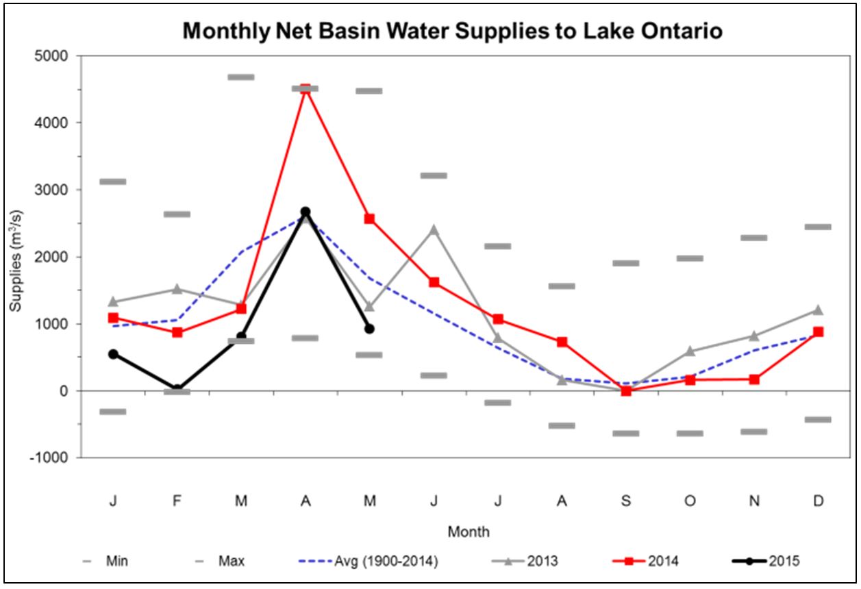
The net result: Water supplies to the Lake Ontario basin itself were at near-record lows in February and March (Figure 3), and water levels declined steadily during these two months.

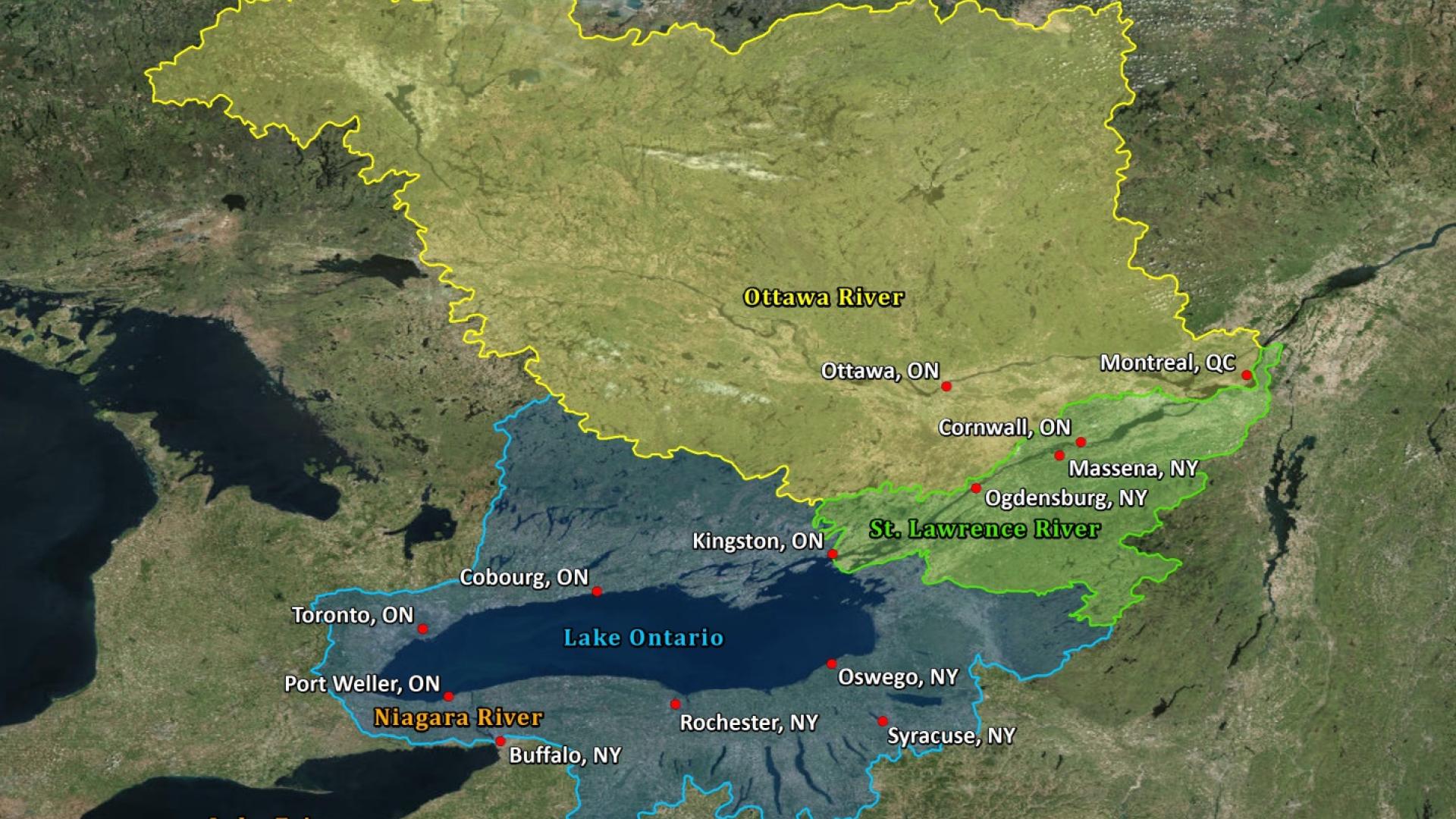
Conditions were relatively dry in the lower St. Lawrence and Ottawa River basins as well, and water levels near Montreal declined during this period. By the start of April, water levels were well below-average throughout the Lake Ontario-St. Lawrence River system (Figure 4).

The effects of outflows and regulation
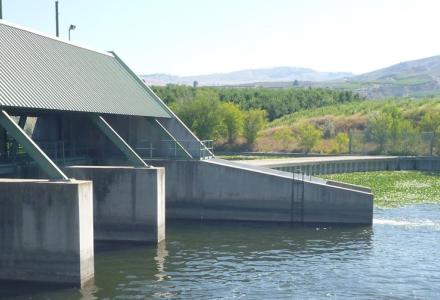
There’s one additional factor that affects water levels of Lake Ontario and the St. Lawrence River: the lake’s outflow. Unlike water supplies, the outflow from Lake Ontario through the St. Lawrence River is controlled.
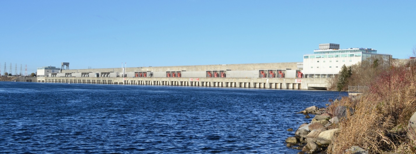
The International St. Lawrence River Board of Control regulates outflows at the Moses-Saunders Dam (Figure 5) at Cornwall, Ontario, and Massena, N.Y., according to a set of rules and requirements laid out in the International Joint Commission’s Orders of Approval. These rules and requirements help define Plan 1958-D, the regulation plan used to determine Lake Ontario’s outflow. The rules are based in large part on water levels and water supply conditions, and include limits on how much outflows can be varied to protect interests upstream and downstream of the dam.
The vast size of Lake Ontario means that outflows play a much smaller role in the lake’s levels than the water supplies do. It’s not at all unusual, particularly in the spring, for a single, wide-spread rain event to raise the lake level by 1 centimeter (0.4 inches) in a single day. But to have this same effect in such a short period, the outflow of Lake Ontario would have to be reduced by more than 2,000 cubic meters per second (70,600 cubic feet per second), or about 30 percent.
Such a large change in outflow would not be permitted, in part because Lake Ontario outflows have a much larger influence on water levels of the St. Lawrence River. For example, a reduction in outflow of just 300 cubic meters per second (10,500 cubic feet per second) can lower water levels near Montreal by almost 10 centimeters (3.9 inches). This same reduction can raise levels on Lake St. Lawrence immediately upstream of Moses-Saunders Dam by about the same amount, and therefore, the effects throughout the system must be considered prior to any such flow changes.
Because water supplies play such a large role in the water levels of Lake Ontario, and outflows have a much larger influence on water levels of the St. Lawrence River, the Board is often able to temporarily adjust the outflows to provide short-term benefits to downstream interests without harming interests upstream. For example, the Board often decreases flows in the spring to reduce the threat of flooding downstream and may adjust outflows to assist with boat haul-outs in the fall. It also increases flows at times to raise water levels and assist ships entering the Port of Montreal.
That said, upstream interests on Lake Ontario are not forgotten, and the effects of these temporary flow changes on Lake Ontario – though typically quite small – are normally compensated shortly thereafter with offsetting flow changes. Furthermore, the Board has periodically deviated from the regulation plan and adjusted flows for the benefit of interests on Lake Ontario. At times, outflows have been decreased to reduce the possibility of extreme low levels, and at other times they have been increased to reduce the possibility of extreme highs.
However, the effects of such deviations are limited, in part due to the limitations and requirements described above, and also because regulation Plan 1958-D adjusts outflows in response to water supplies and in consideration of levels upstream and downstream.
This spring, the regulation Plan responded to the generally dry conditions experienced by specifying outflows that have been below-average since March. Despite this, water levels of Lake Ontario have remained below average. At the same time, the low outflows have also been a major contributor to the well below average levels downstream in the St. Lawrence River near Montreal. Any further adjustments to outflows to raise levels for the benefit of one of these areas would lower levels at the expense of the other.
Current and expected conditions this summer
Since the end of March, water supply conditions have been closer to normal. Spring rains coupled with snowmelt caused Lake Ontario to rise sharply in April, and as is typical this time of year, the seasonal rise has continued through May and the start of June. However, the below-average outflows and more seasonable spring conditions have not been enough to completely offset the effects of the extraordinary winter that just passed, as Lake Ontario began the month of June at 18 centimeters (7.1 inches) below average, the lowest it’s been this time of year since 2010.
Similarly, levels near Montreal also rose in April, before again declining following the end of the Ottawa River freshet, and have remained well below average since then. On average, levels at Montreal Harbour were more than 1 meter (3 feet) below the long-term average in May, and remained well below average at the start of June.
As far as what to expect this summer, that will again depend on water supplies. Though difficult to predict, the most recent water level outlook for the next several months suggests levels of Lake Ontario will continue to rise into the summer months, and should return to their average seasonal values unless conditions prove especially dry (exceptionally wet weather through the first few weeks of June has caused Lake Ontario to rise rapidly; levels were very close to average at press time).
On the other hand, under most scenarios and notwithstanding short-term fluctuations that occur during rain events, levels in the lower St. Lawrence River are generally expected to continue their seasonal decline, but should remain above navigational chart datum through most of the summer.
While recent low water levels are causing discomfort and inconveniencing some interests, Lake Ontario is still well within the lake’s upper and lower limits, and water levels along the St. Lawrence River are still within their normal ranges. Since water supplies are the main driver of water levels throughout the Lake Ontario- St. Lawrence system, all interests should be prepared for a wide range of levels, both now and in the future.