Great Lakes water levels usually fluctuate over time, as in months and years. But a couple of communities along Lake Superior and Michigan recently saw drastic changes in a matter of hours.
On Sept. 4, the water levels of Lake Superior near Sault Ste. Marie, Michigan, rose and fell by 65 inches (1.65 meters). They dropped by 14 inches (36 cm), then rose by 51 inches (1.3 m), all in a couple of hours.
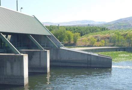
Shorelines were covered in water, which also encroached on homes in the Soo’s Cottage Lane area. Along Lake Michigan, docks were under water at the Petoskey Marina.
The events were the result of what’s known as a seiche.
A seiche (pronounced saysh) is a long wave that can be caused by any weather pattern pushing on water and stacking it on one end, like water in a bathtub. Once the storm has moved on, the piled-up water surges back. This sloshing can go on for hours, or days.
Seiches are often mistaken for tides. Tides of less than 2 inches (5 cm) occur twice daily on the Great Lakes, but water levels are primarily influenced by meteorological effects.
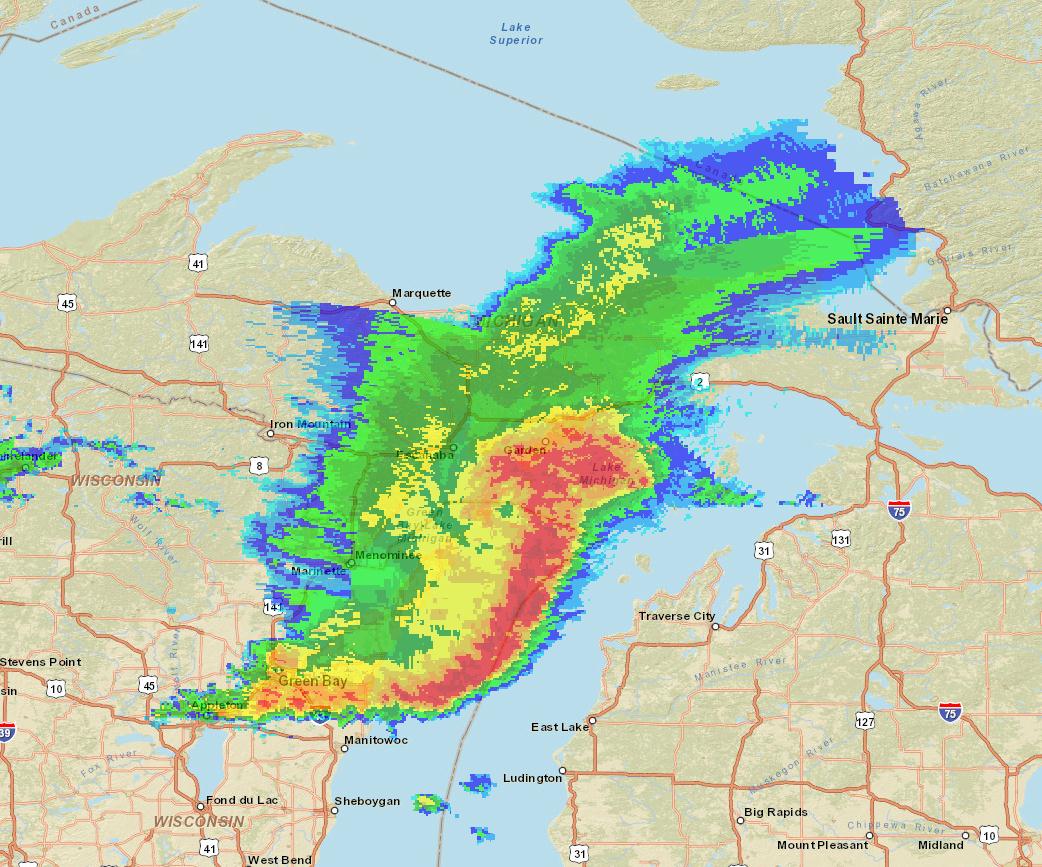
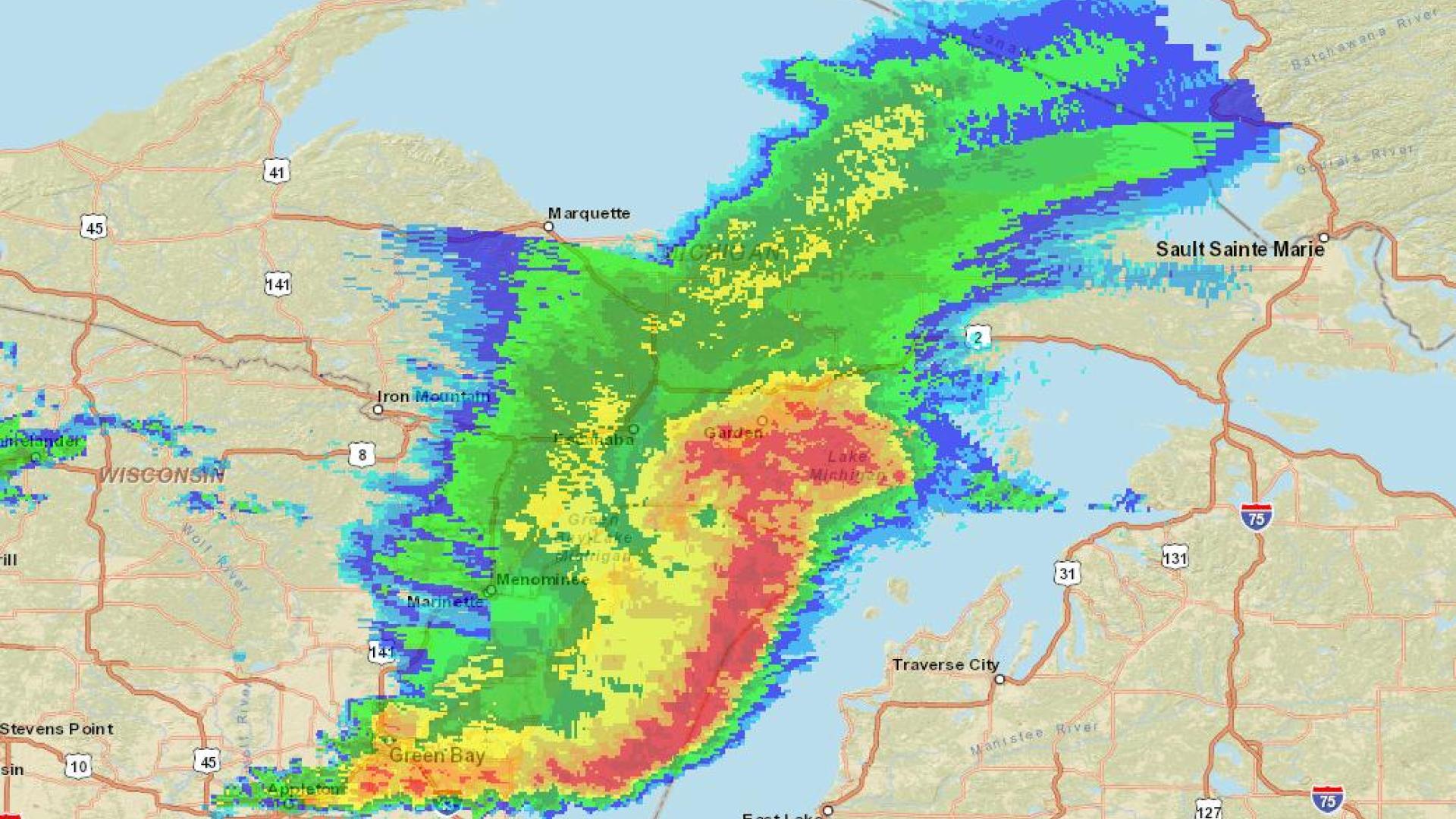
Radar mosaic (reflectivity), highlighting rain conditions over Lake Michigan on Sept. 4, 2014, at 1:55 p.m. Eastern. The colors range from darkest blue (indicating no-to-little rain) to dark pink (indicating intense rain). Credit: NOAA/NCDC.
The September seiche was caused by a storm that moved west to east over northern Lake Michigan, the state of Michigan’s Upper Peninsula, and the eastern end of Lake Superior.
The storm was moving at speeds of about 30 meters per second, or 67 mph, said Eric Anderson, a physical scientist at the NOAA Great Lakes Environmental Research Laboratory in Ann Arbor, Michigan.
The Great Lakes lab is a research arm of the National Oceanic and Atmospheric Administration, and develops models to improve weather and marine forecasts for the lakes and connecting channels.
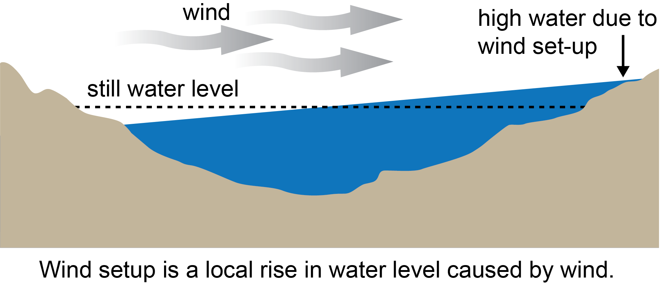
How a seiche occurs. Credit: NOAA Great Lakes Environmental Research Laboratory.
“Seiches happen all the time on the lakes and they can range from benign to destructive depending on the intensity of the weather system,” Anderson said.
Through its Great Lakes Coastal Forecasting System (GLCFS), an experimental set of computer models, the Great Lakes lab in Ann Arbor forecasted the most recent seiche, but under-predicted its intensity.
“In order to predict how these storms will impact the lake, we rely on the over-water conditions that we know very little about,” Anderson explained.
The missing information includes wind speed and direction over the lake. There are land-based meteorological stations that surround the lakes, along with airport stations and government offices. But for the most part, over-water conditions can only be estimated from that data. Added to that is the uncertainty associated with forecasting the over-water conditions.
The wind speed measured at land stations during the September seiche was up to 30 knots (almost 35 mph or 56.3 kph), with a sharp pressure drop over 18 minutes.
“What you’re seeing is a storm front that brings dramatic changes in wind speed and air pressure that initiates the seiche by pushing water toward one end of the lake,” Anderson said.
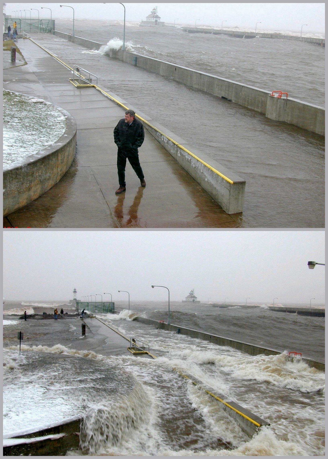
Top and above: A seiche that hit Canal Park in Duluth, Minnesota, in 2002. Credit: Minnesota Sea Grant.
Scientists who study the seiche phenomena also are looking deeper into related weather events called meteotsunamis.
These meteotsunamis are driven by similar convective storms, but require a very specific set of conditions and are rarer than a seiche event. Researchers are still working to understand just how they occur and how frequently they impact the lakes.
Some extreme seiches in recorded history have turned out to be classified later as meteotsunamis. That’s the case with a 10-foot wave on Lake Michigan in Chicago in 1954, which swept eight fishermen to their deaths.
“In the ocean, with an earthquake or similar seismic event, you get a tsunami, which means ‘harbor wave,’” Anderson said. “However, in some cases, the right set of meteorological conditions can also generate a tsunami wave, hence the term meteotsunami. In the Great Lakes, these weather conditions that create meteotsunamis look like squalls.”
Seiches and meteotsunamis have different effects. “A meteotsunami generally comes in the form of one to a few waves, for instance, spaced only a few minutes apart, which impacts a localized area of a lake,” he said.
“Seiches are standing waves that oscillate within the entire lake. Therefore, they impact the whole lake. Depending on the intensity of the weather system, you get can flooding on one end of the lake and dry conditions on the other.”
Where seiches last for hours, meteotsunamis last for minutes.
Weather systems that can induce seiches happen frequently, “with every moving weather system, you have the chance for a seiche to occur,” Anderson notes.
“Generally, you see the more intense conditions in the fall. Only the intense systems cause a seiche. The lakes are always sloshing, sometimes dangerously, sometimes not.”
On the Great Lakes, there are typically one to two intense seiches per year, per lake. Lake Erie, being the shallowest, tends to see the most events.
The Great Lakes Environmental Research Lab in Ann Arbor is constantly working on the next generation of models for forecasting seiches, meteotsunamis and other weather events.
“We understand seiches and we can predict those,” Anderson said. “The meteotsunami is still somewhat of a mystery. We’re still trying to understand the mechanisms that cause them and how we might be able to forecast them in the next generation of computer models.”

Subscribe to our Newsletter!